
Walk a Pearland Street by Address
The useful result from a Pearland street directory is a documented parcel trail, not a claim that every person at an address is public. Begin with the current site address in the Brazoria Central Appraisal District. Save the owner name, situs, mailing line, PID, geo_id, legal description, land-use field, exemption flag, and selected tax year. Then use the city map to see the parcel in relation to the street, nearby lots, subdivision, county line, ZIP, and annexation layers. That sequence keeps each record tied to a specific place.
- Enter the street number and street name in BCAD eSearch. Leave prefixes, suffixes, and unit numbers out of the Street Name field, as the form directs.
- Open the address in the Pearland Interactive Map, select the parcel polygon, and record the PID, legal description, and displayed overlay context.
- Check the current owner as a grantee in the County Clerk real-property route, then capture the prior grantor and legal description from the instrument.
- Use Texas voter information only as an individual, record-specific confirmation when permitted. It is not a street-wide household export.
- For an earlier address hypothesis, consult the verified Greater Houston white-pages run or another identified directory edition, then test the address against deeds or census material.
Repeat the steps parcel by parcel rather than blending data across a whole block. A right-of-way, new subdivision, exempt parcel, or spelling difference can explain why a map and an address query return different counts. Note: A street-wide research note should describe parcels and public records, not publish a roster of households.
Search Pearland Streets in BCAD
BCAD is the appraisal authority for ownership and tax-roll data, even when a county GIS layer helps orient the map. Its search form provides a direct street route and several ways to recover from a no-result. A unit, a recent development, or an inconsistent street spelling can be better approached through a property ID, geographic ID, or subdivision search. The owner field uses a last-name-first-name format. A tax year can be selected, but the official material does not state the historical start year of the web search.
| BCAD field | Input | Required | Street-search use |
|---|---|---|---|
| Owner Name | Text | No | Use last name first name for an ownership lead. |
| Street Number / Street Name | Text | No | Pair both fields; do not add a prefix, suffix, or unit to the street-name field. |
| Property ID / Geographic ID | Text | No | Direct route after a map or appraisal result supplies an identifier. |
| Subdivision / Condo / MobileHomePark | Autocomplete | No | Useful when an address belongs to a development or specialized property group. |
| Tax Year | Select | No | Applies the available dynamic year filter. |
| Abstract | Autocomplete | No | Provides a survey or abstract route when a street address is weak. |
| Pearland GIS address / owner / property ID | Search text | No | Maps a location or owner lead to a parcel. |
| Parcel PID / geo_id / owner_name | Result or query field | Not applicable | Preserves the map-linked parcel identity. |
| Parcel situs fields and ZIP | Result or query field | Not applicable | Normalizes the street address shown on the parcel layer. |
| legal_desc / legal_desc2 | Result or query field | Not applicable | Bridges the parcel to a deed or plat search. |
| LandValue / ImpValue / AppraisedValue | Numeric result | Not applicable | Supplies appraisal context for the selected parcel. |
| hs_exempt / Land_Use_Type and layers | Result and map controls | No | Adds exemption, use, ZIP, annexation, district, and boundary context. |
Search broad first, then narrow. A small change in spelling can be enough to recover an address, and an abstract or subdivision can bridge a property where a historic deed never used the current street number. The appraisal result is still an ownership clue, not proof of who is present there today.
Map a Pearland Street Parcel by Parcel
The City of Pearland GIS tools let a street search shift from a text result to a visible parcel. The city says its map tools support address, owner, and property-ID searching, layers, and measurement. Its parcel service exposes owner, situs, legal-description, value, and address fields. That makes GIS well suited to checking adjacency and jurisdiction, while BCAD remains the source for appraisal ownership questions and the Clerk remains the source for recorded instruments.
The Pearland parcel service displays the field structure used to connect a parcel to its map record.
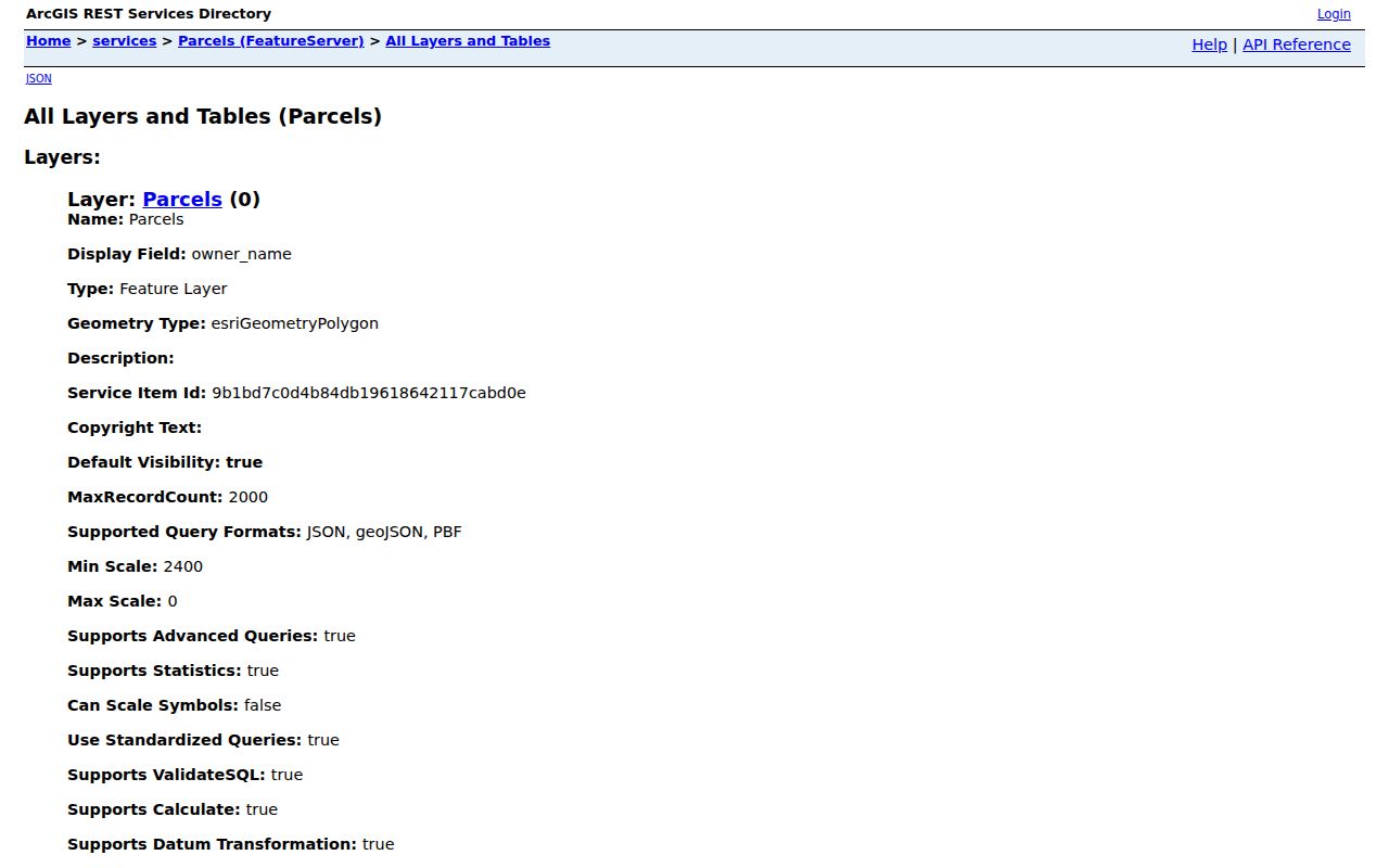
Use the result fields to preserve the parcel identity before moving between the map, BCAD, and a deed index. The service supports advanced and distance queries, but its 2,000-record limit means a broad map result should be narrowed rather than treated as a complete citywide answer.
Turn on ZIP, subdivision, municipal-utility, annexation, county-line, emergency-service, planning, district, and block-group layers as needed. Pearland reaches toward Harris and Fort Bend County geography, so a Pearland mailing label does not by itself settle the custodian. The map is especially useful near an annexation edge or a street that crosses an overlay boundary.
Pearland Street Records by Address
Different address records reveal different parts of a street. The appraisal roll identifies a parcel and owner record; the map supplies spatial context; a deed or plat supplies the title trail; a permit can date a recorded project; and older directory material can suggest a historical subscriber. The access channel matters just as much as the record type. Several current sources are online, but older material may require the Clerk counter, a copy request, a library, or Texas State Library and Archives Commission microfilm.
| Address record | Custodian | Street-level evidence | Access path |
|---|---|---|---|
| Appraisal roll | BCAD | Owner, mailing and situs lines, value, exemption, PID, legal description | Free eSearch; online historical start not stated |
| Parcel geometry | Pearland GIS | Parcel shape, address fields, owner link, adjacent lots | Free map and FeatureServer |
| Deed and plat index | Brazoria County Clerk | Grantor, grantee, instrument, legal description, plats, liens, releases | Tyler entry, public terminal, counter, copy request, or TSLAC microfilm |
| Permit layer | City of Pearland | Location, issue date, status, case, applicant, property owner | Public ArcGIS layer; Cityworks account for transactions |
| Voter registration | Texas SOS / Brazoria Elections | Individual registration and precinct information, subject to limits | My Voter Portal or lawful file-request route |
| Historical listings | UT, TSLAC, BCLS, archives | Subscriber or household clues in a particular edition | Catalog, onsite, licensed, or staff-assisted access |
The County Clerk describes its web database as a convenience database rather than the official, complete repository. If the online index ends, use the Angleton public terminal, request copies through the Recording Department, or consult the county microfilm inventory. The oldest verified deed books begin in 1837, but the current web-index start year is not published in the official material.
Read Pearland Address Fields Carefully
Address terms look interchangeable until records disagree. Keeping each one in a separate note prevents a tax-notice address from being repeated as a parcel location or a deed description from being reduced to a modern street label.
- Parcel
- A defined piece of land represented by a map polygon and linked identifiers such as a PID or geo_id.
- Situs address
- The location of the property itself. It is distinct from the owner mailing address in the appraisal record.
- Legal description
- The lot, block, subdivision, survey, abstract, tract, or acreage language that identifies land in a deed or plat.
- Plat
- A recorded map that lays out lots, blocks, streets, or subdivision boundaries.
- Criss-cross directory
- An address-ordered listing, when an edition includes one, that can be used to test a historical street hypothesis.
A homestead flag may support an owner-occupancy inference, but it is not a household list. Likewise, an owner mailing line can point to an agent, business, or out-of-area destination. Preserve both lines and record which field supplied each fact.
Follow Deeds Along a Pearland Street
Use the address search only to reach the parcel. The title trail then moves through the legal description. Search the current owner as a grantee in the Brazoria County Clerk Recording Department route, retrieve the purchase instrument, and note its number, recording date, prior grantor, grantee, and legal description. Search the prior grantor as a grantee to continue backward. Older deeds may omit the current street address, making lot, block, subdivision, survey, or abstract terms essential.
The online entry point may require an account for some functions. At the counter, the Clerk provides public computers and access assistance. A request for copies can specify a party name, instrument number, volume/page, legal description, date or type, and whether an uncertified or certified copy is needed. The official copy charge is $1 per page, with an additional $5 per document for certification. TSLAC microfilm becomes the fallback for older volumes and indexes.
Do not build a chain from a common name alone. Confirm the legal description at every transfer, especially when the same owner has several parcels along a street. Note: A property-fraud alert can identify a recorded document event, but it is not a title opinion or proof that a transfer is valid.
Pearland Address Permit Records
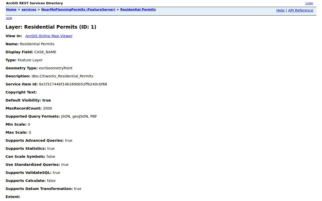
A permit layer can add a construction or inspection timeline to a Pearland address search. The public Residential Permits layer exposes DATE_ISSUED, BUS_CASE_DESC, CASE_STATUS, LOCATION, CASE_NAME, CASE_NUMBER, Applicant, and PropertyOwner when populated. It supports query, pagination, and distance searches, with a maximum record count of 2,000. It is evidence about a city case, not an account of everyone connected to an address.
The Pearland address-keyed permit layer shows the public query surface used for a location search.
Cityworks became the current permit and inspection channel in January 2025. The public historical coverage start was not located, so a missing result should not be read as proof that no earlier record exists. For a missing city record, the City Secretary accepts existing-record requests through JustFOIA, a form, mail, in person, and email.
Pearland Streets and Old Town Geography
Old addresses need a geographic check before they are sent through a modern address search. Pearland’s original townsite was platted in 1894 at the Brazoria courthouse. The 2040 plan gives its bounds as current Orange, Walnut, Galveston, and Austin streets. The city history also records early east-west names including Walnut, Pear, Broadway, Jasmine, Plum, and Orange, and north-south names including Austin, Pearland, San Antonio, Washington, Texas, Sacramento, Main, Houston, Grand, Park, and Galveston.
Those names are useful search anchors when an old deed supplies only a lot, a rail reference, or a nearby cross street. Compare the historic vocabulary with a current parcel, plat, and map layer. Pearland incorporated in 1959 and has added areas through 2024, so a historical record may use county or nearby postal geography before the parcel appeared within city limits. No citywide street-renumbering project with a date was located in the official research.
Past Pearland Street Listings
For postwar address research, UT Austin catalogs Greater Houston Residence White Pages with Pearland and Brazoria County locations in runs from 1956 through 2005. They are Southwestern Bell/SBC telephone and address listings, not a complete city directory and not title proof. Record the exact edition and page, then compare the address with a deed, census, or parcel source. The historical collection method and access limits are described in the Pearland Directory Book.
TSLAC notes that directory forms can be alphabetical, by address, or by telephone. A reverse or criss-cross volume is strongest for a street question, but omission is ambiguous. Rural routes, unlisted service, an address change, and uneven coverage can all make a subscriber disappear from one edition. The right record is a dated lead to test, not a stand-alone residence conclusion.
Limits of a Pearland Street Directory
Street records do not reveal every resident. A public parcel may show an owner while the actual occupants are absent. Utility customer information, DMV addresses, USPS delivery data, private association membership, protected voter information, and Address Confidentiality Program addresses have separate limits or are not public. Texas My Voter Portal is a person-by-person lookup, not an address-wide download. A public-record boundary is a result worth preserving.
When a needed city record is not online, use the Pearland City Secretary public-records route to ask for an existing record with the address, case number, department, and date range. The Texas Public Information Act does not turn protected information into a public street list, and a custodian may release only what the law allows.