
Pearland Neighbors at Parcel Level
The immediate block has several public layers, and each answers a narrow question. Pearland parcel GIS helps identify adjacent lots, geometry, situs information, legal descriptions, and owner links. BCAD is the authority for appraisal and ownership data. County GIS adds public engineering and boundary context, while city layers can show subdivision, municipal utility district, annexation, zoning, and other overlays. A voter lookup is person-by-person, not a map of a block. Community contacts are organization-level leads, not proof that any household belongs to an association.
| Block source | What it can establish | Access route |
|---|---|---|
| Pearland parcel GIS | Adjacent polygons, parcel IDs, owner links, situs and legal-description fields. | Free interactive map and parcel service. |
| BCAD street or subdivision search | Current owner and parcel records for an address, street, or subdivision search. | Free eSearch. |
| Brazoria County GIS map | County line, public districts, engineering, road, and map context. | Free public web map; ownership questions go to BCAD. |
| Pearland permit layer | Location, issue date, case status, and populated applicant or owner fields. | Free ArcGIS layer; historical start is not stated. |
| Texas voter lookup or file request | Individual registration or precinct confirmation subject to protected fields. | My Voter Portal or lawful request route. |
| City planning and district layers | Zoning, permitted-use links, public district, ZIP, and annexation context. | Free city GIS layers. |
| BCLS and historical society | Local history, photos, yearbooks, and research leads. | Library or society contact. |
| Public association pages | Voluntarily published organization name or contact path. | City association page or an association’s public route. |
These records do not combine into a verified list of everyone on the block. A parcel owner can use an out-of-area mailing address, an applicant can be a contractor, and a historical subscriber can be absent from a current record. Treat each result as evidence for the specific record question it answers.
Pearland Blocks Through GIS Layers
The City of Pearland GIS tools support address, owner, and property-ID searches, layer toggles, measurements, and map PDFs. The parcel service includes a PID, geographic ID, owner name, situs components, legal description, parcel geometry, values, land-use type, and homestead-exemption field. The BoundaryLayers service adds county lines, subdivisions, municipal utility districts, ZIP codes, annexation ordinances, emergency-service districts, abstracts, block groups, and public districts.
Pearland’s published BoundaryLayers service is the source for the city layer view.
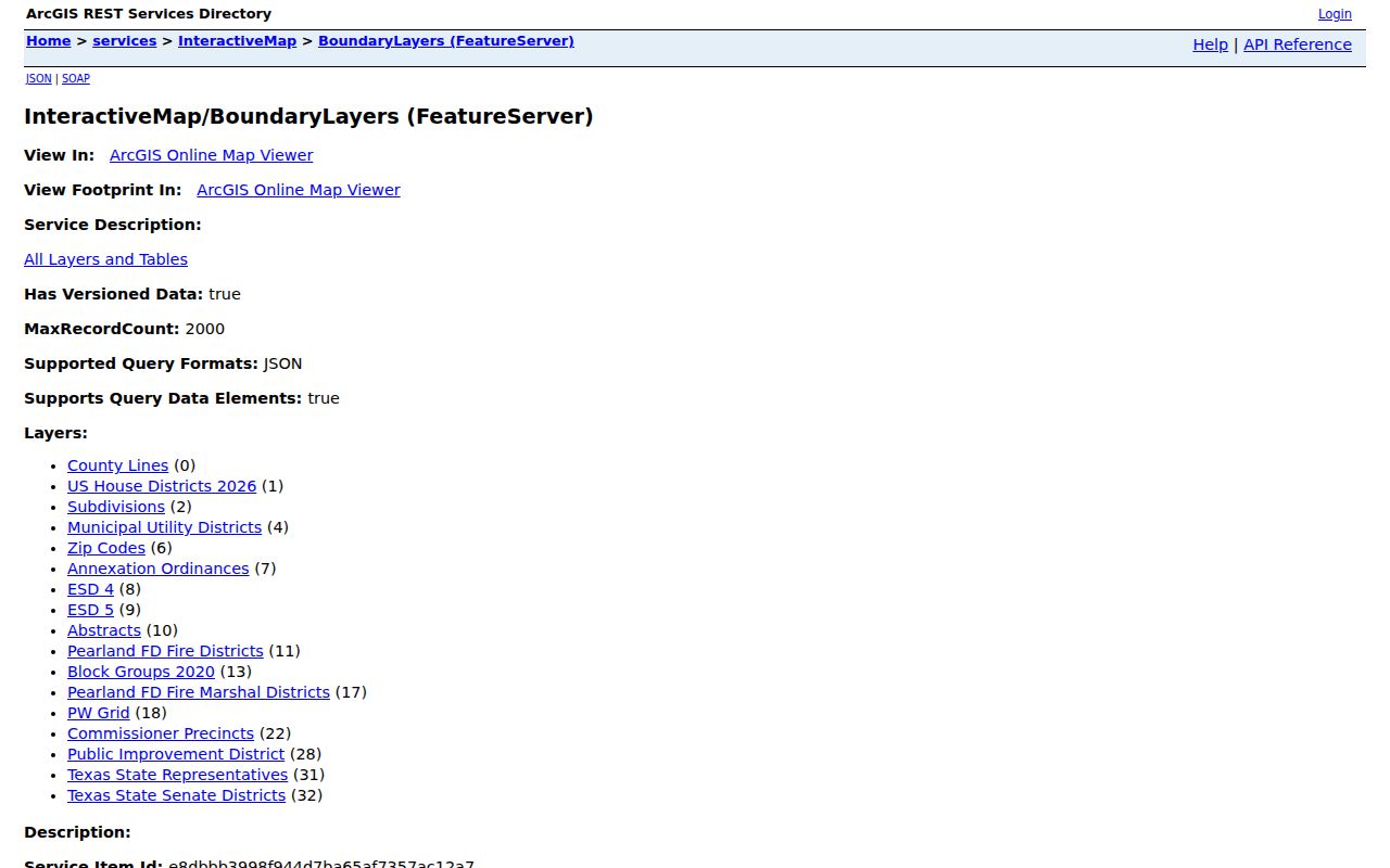
The layer image shows why a block should be read as both a group of parcels and a set of overlapping public boundaries. Use a layer to explain jurisdiction, not to infer household membership. The parcel map is best for spatial adjacency, while BCAD and the County Clerk hold the records behind ownership and recorded instruments.
Mapping Pearland Neighbors Parcel by Parcel
The adjacent-parcel method starts with geometry. Open the Pearland Interactive Map, find the address or PID, and zoom until parcel outlines are clear. Click the target polygon and then the lots sharing a boundary or facing it across the street. Save the parcel identity, situs address, legal description, ZIP, and relevant public overlays for each one. The public materials do not confirm a one-click neighbors report or automatic radius export, so the work must stay at the parcel level.
- Locate the target address or PID in the city map and record its legal description before moving outward.
- Select each adjacent or opposite parcel. Keep the PID and address separate for every lot.
- Open the associated BCAD record to compare owner, situs, mailing, subdivision, and current tax-roll context.
- Turn on subdivision, ZIP, utility-district, annexation, county-line, zoning, emergency-service, and block-group layers when they explain a boundary difference.
- Use the measure tool for distance or frontage. For a full named-street chain, use the Pearland Street Directory rather than expanding a block search into a streetwide household list.
A homestead field may support an owner-occupancy inference, but it cannot establish who else is present. The owner mailing field is also not a residence finding. It identifies where an appraisal notice is sent, which can be a business, an agent, or another address.
Pearland Neighbor Owners and Occupants
Compare adjacent owners only after confirming the legal description and parcel boundary. Common names can create a false connection, and a lot may be exempt, new, vacant, or part of a right-of-way. BCAD’s address search uses Street Number and Street Name, with no prefix, suffix, or unit number in the street-name field. When a block contains a newer development or an unusual address format, subdivision, property ID, or geographic ID can be more reliable than a broad street query.
The property trail should remain a parcel trail. A deed and appraisal record may establish an owner of record. They do not establish every person at an address. The city’s public permit layer can add construction context through DATE_ISSUED, CASE_STATUS, LOCATION, CASE_NUMBER, Applicant, and PropertyOwner when populated, but it also does not identify a complete household. Cityworks became the current permit route in January 2025, and earlier public-layer coverage was not stated.
Note: Save the map layer date and query date when two public maps differ, especially near an annexation or county boundary.
Pearland Neighbor Voter Data Limits
Texas My Voter Portal accepts individual lookup inputs such as name, county, date of birth, ZIP, VUID, or a qualifying driver-license route. A result can provide registration and precinct context, but it does not promise an address-wide export. Brazoria County also links to a voter-file request process, yet a lawful request remains subject to the Secretary of State layout, confidentiality exclusions, and the applicable delivery and fee rules. The research did not locate a current Brazoria-specific file fee or delivery schedule.
Protected voter addresses, Address Confidentiality Program participants, Social Security numbers, identity-number fields, and phone numbers must not be reconstructed. A no-match only means the portal did not find a record under the submitted inputs. It does not prove a person has never been registered, and it does not turn nearby parcels into a list of voters.
Pearland Neighbor Community Contacts
The City’s association contact page is the official organization-level route for nearby civic context. It names community associations including Estates of Pearland, Green Tee Terrace, Silverlake, Pearland Farms, Southfork, and Southgate. The City says its database is not complete, is updated routinely, and may contain out-of-date contact information. That warning controls how the list should be used.
| Organization named by the City | Public contact route | Status to retain |
|---|---|---|
| Estates of Pearland | City association contact page | Organization contact only; confirm current details. |
| Green Tee Terrace | City association contact page | Organization contact only; City list may be incomplete. |
| Silverlake | City association contact page | Organization contact only; details may be out of date. |
| Pearland Farms | City association contact page | Organization contact only; no membership inference. |
| Southfork | City association contact page | Organization contact only; verify before relying on it. |
| Southgate | City association contact page | Organization contact only; not a resident roster. |
The City’s association update form is also for organization contact information. The exact live form labels and required fields were not fully exposed in the official static material. Neither the association page nor the form supports a conclusion about which homes participate. No complete block-watch roster or historical association-by-subdivision coverage was located.
Pearland Neighbor Block Boundaries
Pearland is a multi-jurisdiction records problem. Brazoria County is the principal county, but city limits also extend toward Harris and Fort Bend Counties. City layers show county lines and annexation context, and the official annexation map includes additions through 2024. Two nearby parcels can therefore point to different county, appraisal, or city systems even when they share a street name or a Pearland mailing label.
Use the parcel layer to locate the lot, then compare county line, ZIP, municipal utility district, annexation, and district overlays before choosing a custodian. A postal ZIP is not a block boundary. A Pearland mailing address can appear outside city limits, and a parcel in the city can carry a different postal designation. This geographic check is especially important before treating an adjacent lot as part of the same public-record search.
Pearland Neighbors: Official and Commercial Records
Official sources and commercial neighbor tools serve different purposes. Official records name their custodian, disclose what the record does and does not prove, and provide a correction path. Commercial tools generally compile public-record extracts, marketing data, historical addresses, and unverified matches. They can be stale, duplicate people, or omit protected information. Neither category overrides the limits on protected voter, utility, or private association data.
| Official public record | Commercial compiled tool | Practical check |
|---|---|---|
| Custodian and record type are identifiable. | Inputs can come from mixed sources and may not show a clear origin. | Save the source, date, and parcel or record identifier. |
| Parcel, deed, or GIS result answers a defined record question. | A match can merge old addresses or similarly named people. | Confirm legal description, date, and jurisdiction with the custodian. |
| Protected fields remain subject to public-record limits. | Compilation does not make protected information public. | Stop when a record reaches a restricted category. |
Brazoria County’s property-fraud alert signup is an official county-directed notification service, not a title opinion or ownership proof.
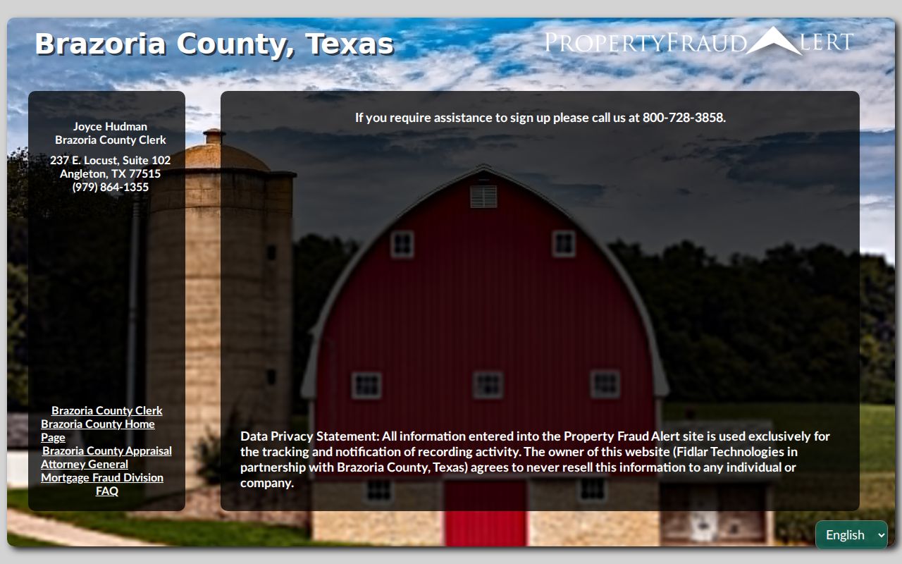
The service can alert a subscriber to a filing, but it does not validate the filing or replace a recorded-instrument review. Use the Recording Department and BCAD to check a property record directly.
Pearland Neighbor Privacy Boundaries
A careful neighborhood search preserves the line between public parcel context and private household information. Utility customer data, delivery information, protected voter details, DMV data, sealed court records, and private association rosters are not a general block directory. The Texas Address Confidentiality Program provides a substitute-address and forwarding structure for qualifying survivors, and other protected voters or officials can have confidentiality protections.
Lawful use. Use Pearland neighbor records for personal, lawful civic or property research. Do not use a public map or record to track, threaten, repeatedly contact, or harass any person.
When a public record looks wrong, contact the custodian that created it. BCAD handles appraisal data, the County Clerk holds recorded instruments, and elections offices handle voter corrections. Public availability is not permission to combine separate records into a threatening profile. A redaction or no-match is a valid outcome.